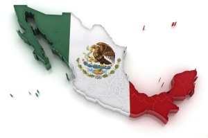
 Ever since 1978, after I purchased my first motorcycle, I’ve wanted to cruise Mexico on a bike. Back in January 2006, I flew to San Diego, California with mi amigo Buster and we rented Harley Davidsons for a five day trek down the Baja Peninsula. That trip was incredible but too short. This trip hopes to fix that… I’m budgeting 60 days to ride the eastern half of this vast and varied country.
The idea is to leave the Chicago area on January 31, 2014. But, being Chicago in January, the weather is usually very cold with temperatures below freezing. A flexible rolling window is needed so the actual departure date will be when high temperatures are forecast to be in the mid-40s. As the route progresses south, the average mean temperatures will steadily rise each day. Extra cold weather gear will be sent home near the Texas / Mexico border.
My 2007 Triumph Tiger will be the cycle ridden on this trip. I was hoping to do this ride on a KTM 990 Adventure as it would be more flexible with the mixed road options thrown at me south of the border. That is not in the cards however, so it’ll be virtually all asphalt aboard the Tiger. Once in Mexico, the route will proceed in a counterclockwise direction with the westernmost point near the city of San Luis Potosti. The original idea was to travel in a clockwise direction, initially hugging the Gulf Coast to the Yucatan. But I need to be at the Monarch Butterfly Sanctuary to witness their wintering grounds near El Rosario, Michoacan before the end of February when they take flight back north to the United States and Canada. This forced my hand into a counterclockwise route and also places me in the Sierra Madre Oriental mountain range in February. There’s no risk of snow being this far south but it will get chilly in the higher elevations.
The trip will then proceed south and east passing through numerous colonial cities before touching the Pacific coast. The route then continues to the extreme northeast corner of the Yucatan Peninsula (principal home of the ancient Mayans) where I’ll camp on Isla Mujeres. Along the way, a side trip into Belize is possible as the route will be only a couple miles from the border. From there it will be a ride west and north that mostly hugs the Gulf Coast, passing brackish estuaries and mangrove thickets that draw hundreds of species of birds along with countless sea turtle nesting sites.
All told approximately 7,000 miles are expected to be ridden on this adventure, with about 4,500 of that in Mexico. There will be a wide range of terrain covered in this mountainous and diverse country:
- The vast, arid, cacti studded Antiplano bound by the Sierra Madre Occidental to the west and the Sierra Madre Oriental to the east. This is the third highest inhabited plateau in the world, trailing only Tibet and Bolivia.
- Three sections of ocean and sea: The Pacific Ocean to the south with surfer bums trying their luck on cresting waves against a rocky backdrop. The Caribbean Sea along the eastern Yucatan Peninsula, boasting sugar-white sand beaches and the second largest barrier reef in the world. And the Gulf of Mexico, home to flamingo wintering grounds and numerous bird sanctuaries.
- Steamy rain forest and jungle within the Yucatan and southern mountain ranges with monkeys, big cats, and colorful birds.
- Porous limestone land, mostly lake and river free, impregnated with hundreds of freshwater cenotes within the Yucatan.
The Wandering Nomad wishes to acknowledge the following publications and blogs/websites for contributing ideas and insight during the planning stage of this trip. Embedded links were sound at the time this post was published. If they break… oh well:
- Adventure Guide Yucatan, Bruce & June Conord, 3rd Edition, 2004
- Let’s Go Yucatan Peninsula: The Student Travel Guide, Harvard Students, 1st Edition, 2009
- Moon Travel Handbooks Northern Mexico, Joe Cummings, 2nd Edition, 1998
- Moon Handbooks Chiapas, Liza Prado & Gary Chandler, 1st Edition, 2009
- Moon Handbooks Oaxaca, Bruce Whipperman, 6th Edition, 2011
- The Adventure Begins, Troy
- Greg’s Motorcycle Adventures, Greg Powell
- South on Two Wheels, Vincent A. Bert
- Yucatan for 91 Days, Michael Powell & Jurgen Horn
Navigation for this route is accomplished primarily with the aid of a Garmin Nuvi 205 GPS mounted to the Tiger. Coordinates of waypoints provided in daily reports are derived directly from the Nuvi or Google Maps and are generally accurate to within 40 feet.
Camera equipment used on this trip ranges from the convenient Kodak EasyShare M763 ultra-compact to a Nikon D3100 digital SLR. Two lenses provide zoom capability between 18-300mm. In some cases, I may use the camera on my Motorola Photon smartphone.