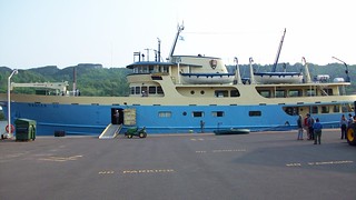
Pulling into the secure fenced Ranger III parking area at 8:15 am Tuesday morning, I choose a space overlooking the canal. My backpack is riding pillion this morning and it’s soon on my back for a short walk where it is tossed into a cart atop other packs for transport in the ship’s belly. Canoes and kayaks are also carried below but larger motorboats are hoisted with a ship mounted crane for transport on the upper deck. I purchase a few postcards at the gift shop then show my ticket and board the boat. The captain, with a blast of the horn, signals our 9:00 am departure and uses a bow thruster to clear the dock then calls upon the dual 850 horsepower engines spinning 76 inch diameter propellers to place the ship into the heart of the channel. Gates along Mi-26 drop to stop traffic and the lift bridge begins to raise the highway pavement 75 feet skywards for our passage. After an hour of cruising west the Lake Superior breakwater is crossed, a vast expanse of water lie beyond. We’re informed the air temperature over the lake is a cool 51 degrees but the water is only 36. A safety briefing on life boats and flotation devices is presented reminding everyone that it’s not drowning you need to fear, it’s hypothermia. At these temperatures a person will become unconscious in 15 to 20 minutes and die in less then 45.
Under hazy sunshine, the journey across the lake over calm water is uneventful. Isle Royale is the only national park that shuts down for the winter season. When it reopens in mid-April, most all people visiting the island are backpackers. That’s because the Rock Harbor Lodge and restaurant don’t open until today. With the attractive half price Ranger III fare and an enticing open lodge, the ship has about 100 passengers divided into three categories: lodge guests, park volunteers or backpackers. I doubt if more than 35 were backpackers. After the safety briefing, backpackers assembled to get a leave-no-trace protocol talk and then forms are handed out to list noncommittal itineraries (campgrounds hikers intend to visit). It’s all typed up below deck then a free backcountry permit is issued. The permit is then hung on your tent or shelter door when bedding down for the night. Note the issue of permits is only done on the Ranger III and no other transportation to the island provides this service. If other means are used to arrive at the island, permits must be obtained at the park office at either Rock Harbor or Windigo. Since I took advantage of the Ranger III Birthday Celebration fare my cost was $63 for round trip passage plus a 9 day park fee @ $4 per day for a total of $99.
Four hours after departure, Isle Royale appears as a low dark bristle where water and sky merge as one. An hour later, we slip past Rock Harbor lighthouse and enter a long, narrow bay. A brief stop is made at park headquarters on Mott Island where the summer volunteers disembark. Once docked at Rock Harbor, I grab my pack from a cart, fill my water bottles and set off south down the Rock Harbor trail at 3:10 pm under a sunny sky. I’m only going about 3 miles today to the first campground – appropriately named Three Mile. At 48° North, days are long this time of year: sunrise is at 5:55 am and sunset is 9:55 pm. Add two hours for twilight and it adds up to only 6 hours of darkness each day. I have plenty of time for this short hike today. The trail initially passes through Rock Harbor campground, passing numerous shelters and campsites. Soon the true trail begins, skirting the lakeshore. This is a difficult hike. Elevation changes are modest but the ground underneath is brutal.
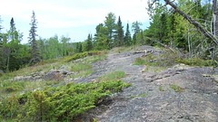
Since it became a national park 75 years ago, the tens of thousands of boots trudging over this ancient stone have done nothing but wear away some moss, lichen and grass growing from cracks. And no wonder. This rock has withstood numerous punishing bouts with ice, sometimes two miles thick, over its surface. That equates to 304 tons per square foot. My puny rubber soled Timberland boots are virtually nonexistent in comparison. This trail is hard (difficult) because it’s hard (non-yielding). Every footfall reverberates through the body, the sloped surface and strewn rocks force eyes-down, vigilant to not trip or twist an ankle. So my first sights on Isle Royale were mostly my feet. Dark grey and brown under sparse shade, the surface warms from the high summer sun. Cairns are stacked here and there to guide the way. After a while I catch up to two girls in their low 20’s that I’ll call Bambie and Fawn. Lithe and nimble, dressed in shorts, neither had trekking poles and each were carrying packs nearly as large as mine. They were taking a break and I mentioned how the trail was killing me. Bambie claimed rock was her favorite type of path: no mud, fewer tree roots, and good grip. Maybe so but it was still killin’ me. And I had trekking poles. They were soon off, headed for Daisy Farm. Sigh, to be young again.
A wooden post shows the way to Suzy’s cave down a path to the right. Removing my pack I walk about 300 feet to a small indentation in a wall of rock. Not too impressive. I arrived at Three Mile campground at 4:55 pm and grabbed the last shelter (#11) along the path, 25 feet from shore. Three Mile is a large sprawling campground yet shelter #10 was practically on top of me. Despite the sun, I wore my rain jacket for the hike and my shirt was drenched in sweat. Now idle, I was beginning to feel really cold so I got into my sleeping bag to warm up. Before I know it I’m passed out then awoke a short time later, my face basting in a puddle of drool. What the Hell!? I pass out again to another puddle and this is repeated yet again. If it’s to be like this after a mere 2.9 mile hike, I can only imagine what tomorrow brings. Grim Reaper, take me now! I kept the stove packed and went with a 7.25 ounce foil pack of pink salmon with stone crackers for dinner. Around midnight, a gentle rain fell while distant lightning lit the blackness.
NOTE: I’m recording my daily hikes using Locus Pro on my Android Smartphone. I didn’t think to calibrate my GPS and as a result, it appears most elevation readings are too low. Lake Superior is 602 feet above sea level and my captured GPS track has me about 100 feet below that, so take the elevation profile(s), including gain and loss, with a grain of salt. Surface track on the other hand looks fairly accurate.
Day 1. Rock Harbor to Three Mile.
Miles hiked: 2.94. Elevation gain: 414 feet. Elevation loss: 413 feet.
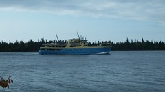
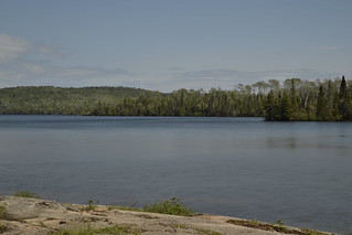
Today I’m up at 6:00 am and take my solar charger to a nearby short pier with an unobstructed view of the sun peering over the horizon. After filtering water, I sat at my picnic table for a routine breakfast of oatmeal with honey and dried fruit. By 8:30 I was preparing for departure. Three items are on the daily checklist: full water bottles, apply sunscreen, and apply bug juice. Two out of three isn’t bad as I neglected to cover my exposed skin with DEET this morning. Cool and sunny, I strap on my pack and set off for Moskey Basin eight miles south. I left the jacket in the pack today and am hiking with only a t-shirt; I don’t want to overheat like I did yesterday. The trail south out of Three Mile follows the shore and is a mostly level narrow dirt path with beautiful harbor views to the left and thick boreal pine forest to the right. Occasional low spots bring mud and pines send wandering shallow roots across the path but it is far easier than solid rock. Docking overnight at Rock Harbor, the Ranger III departs at 9:00 am for its trip back to Houghton. Steaming past, it stops once again at Mott Island before continuing off into Lake Superior. Brief trail side stops have me engulfed in swarms of mosquitoes, my punishment for passing on the DEET, though I soon remedy that situation. I arrive at Daisy Farm where I rest with some lunch on a concrete pier. As I’m munching on trail mix, Bambie and Fawn show to purify water. Instead of a filter, they were using a product called Aqua Mira. We exchanged pleasantries and they vanished into the woods.
After a 45 minute break, I continue south whereby the path turns inland, rises abruptly and once again morphs into a dreaded slanted rock field. Ugh! Low evergreens hug the ground, releasing clouds of lime-green pollen to each stiff breeze. Surrounded by tall pine, few vistas are here. After 1 ¾ miles, rock surrenders to soft wonderful dirt before descending to the lakefront below. A trail junction marker shows the way to Moskey Basin through a short expanse of mud. Longer stretches of muck typically have narrow boardwalks provided to limit erosion and ease the mess. I arrive at Moskey Basin at 2:05 pm and snag the first shelter (#1) encountered and set my gear on the table. But it isn’t a very good location: views of the bay are limited and there’s a huge angled rock right outside the shelter door. Setting off along a long boardwalk I see if there’s anything better. Most shelters are occupied but the last one (shelter #8) is open. And it’s a beauty! Secluded with a gentle slope to the shore and a gorgeous unobstructed view. I quickly retrieve my gear and stake my claim. First order was to filter water as I consumed all I had during the hike. I spot a female common merganser, with its brown wedge-shaped head, floating offshore. Then a lone black and white baby duck, about the size of a tennis ball, paddled a few feet away, diving to the shallow bottom for algae and weeds. Once the duck show was over, I rinsed socks, shirts and underwear then strung a line to dry. A trip to the prive’, only 25 feet from the shelter, revealed a pleasant surprise: six rolls of toilet paper and cleaner than many gas station crappers I’ve visited.
Day 2. Three Mile to Moskey Basin.
Miles hiked: 8.04. Elevation gain: 1336 feet. Elevation loss: 1333 feet.


